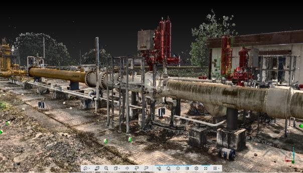
01 / 14
Building & Plant 3D Scanning
Capture accessible site geometry for registered point-cloud delivery.
Industrial plant scan view from the project profile.
 K K Geo System | 3D Scanning & Metrology Solutions India
Ahmedabad & Jamshedpur · On-site across India · Remote modelling worldwide
K K Geosystem provides 3D scanning, dimensional inspection and reverse engineering services for components, buildings, industrial plants and infrastructure.
With offices in Ahmedabad and Jamshedpur, we undertake on-site assignments across India. We also support overseas customers with Scan-to-CAD, Scan-to-BIM, as-built plant modelling and drawings from customer-supplied scan data.
Project photographs, scan views and clearly labelled concepts. Select a service to learn more.
01 / 14
Capture accessible site geometry for registered point-cloud delivery.
Industrial plant scan view from the project profile.
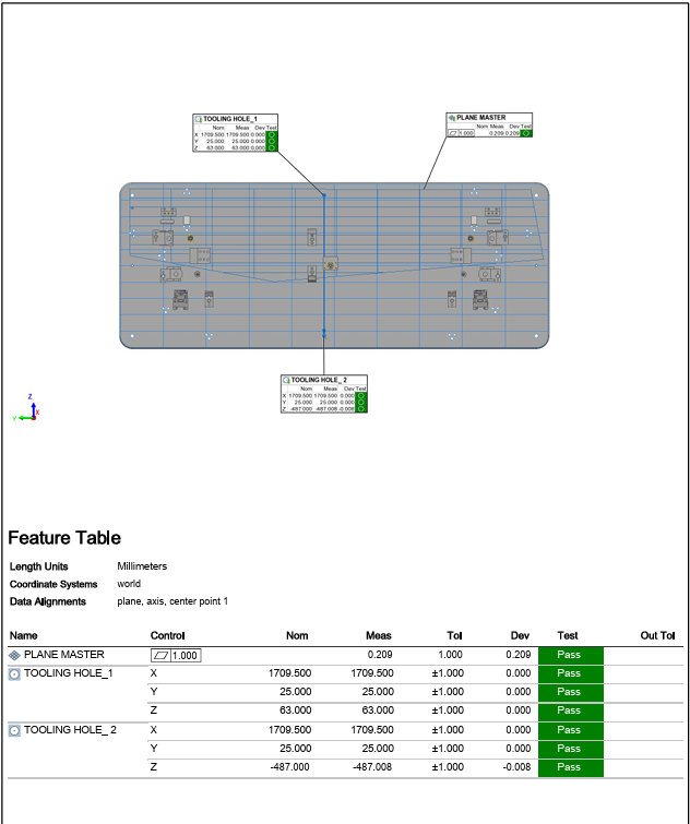
02 / 14
Inspect critical dimensions against drawings and specified tolerances.
Portable CMM inspection report example. Identifying footer removed.
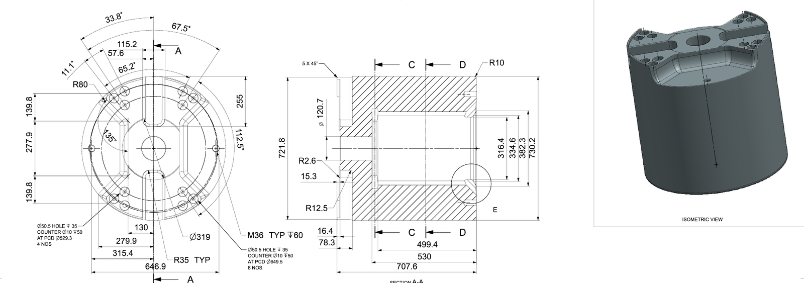
03 / 14
Develop CAD models and drawings from components or supplied scans.
Dimensioned drawing and 3D CAD model extracted from a reverse engineering drawing.
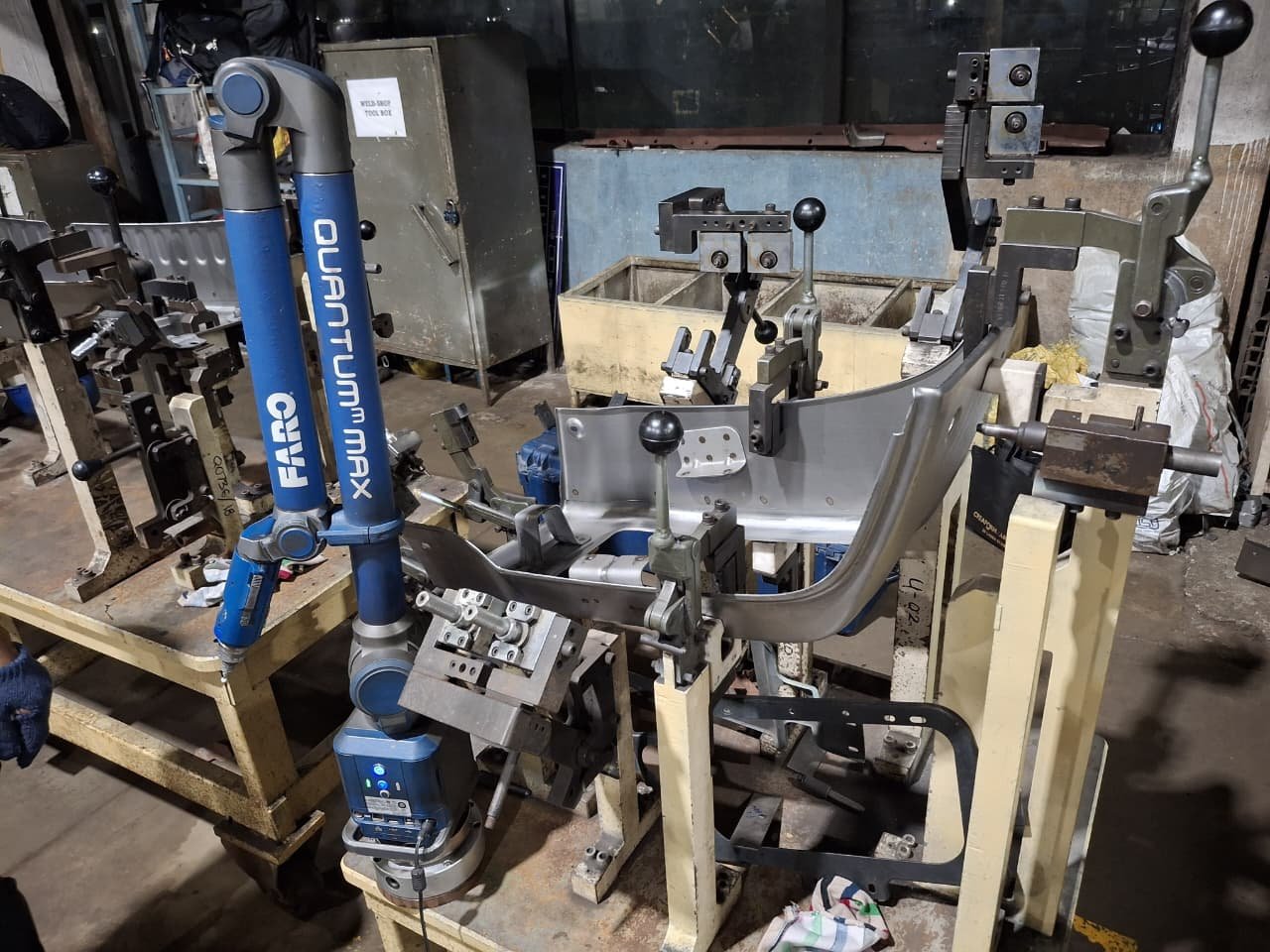
04 / 14
Check locating features, guide adjustments and remeasure.
Portable CMM setup for jig and fixture verification.
05 / 14
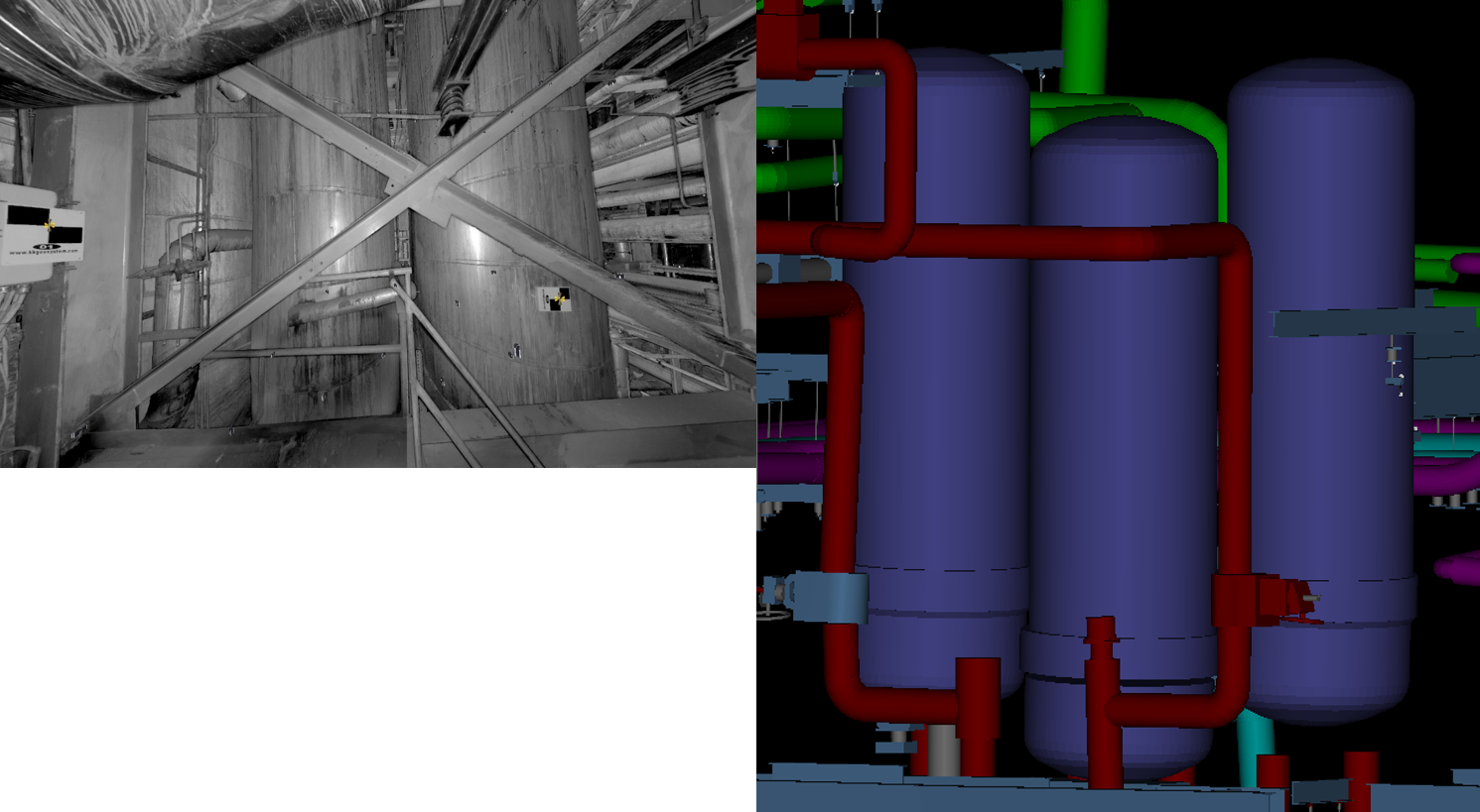
Document existing piping, equipment and structures.
Plant scan view alongside an as-built model of equipment and piping.
06 / 14
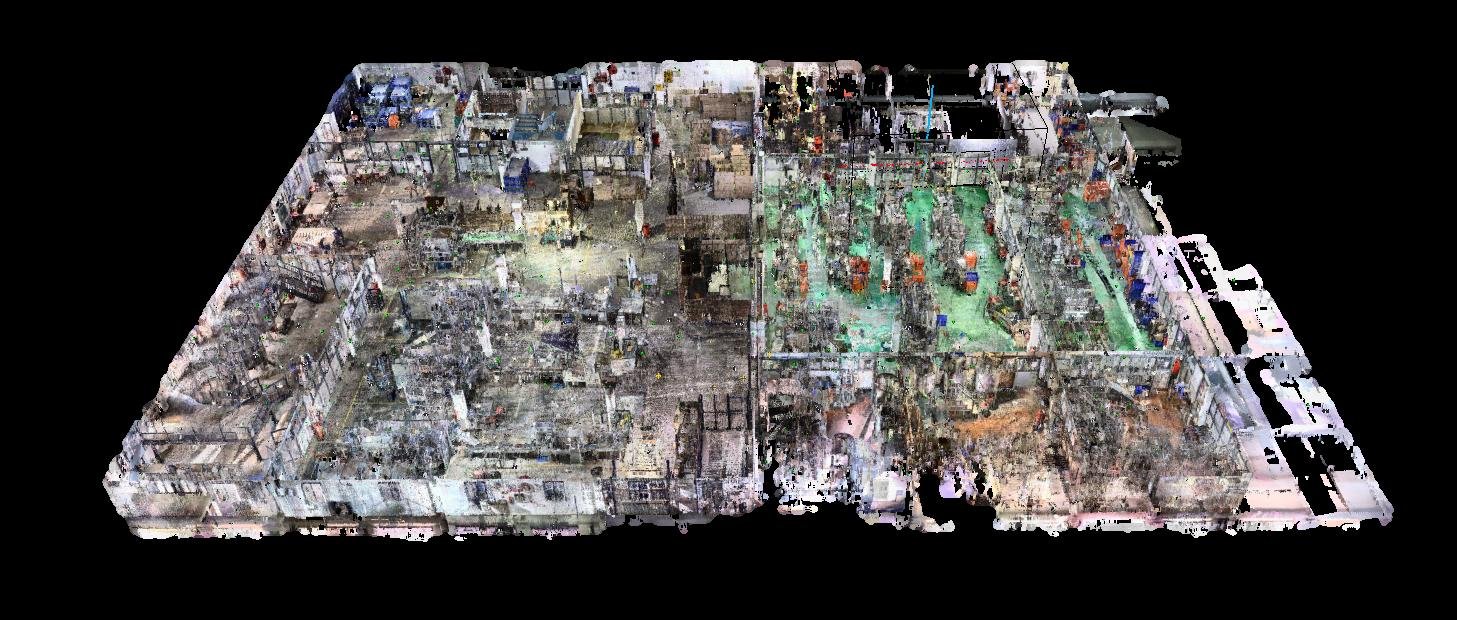
Convert building scans into agreed BIM models and drawings.
Registered retail-building scan from the project profile.
07 / 14
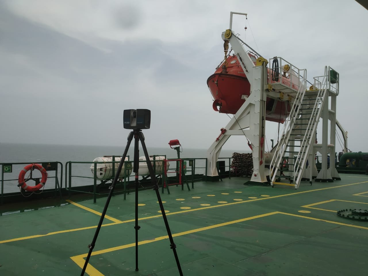
Capture ship spaces for marine engineering and retrofit workflows.
On-board laser scanning of ship deck structures and equipment.
08 / 14
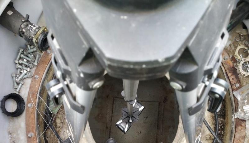
Capture tank geometry for volume charts and reporting.
Scanner arrangement for tank capture from the project profile.
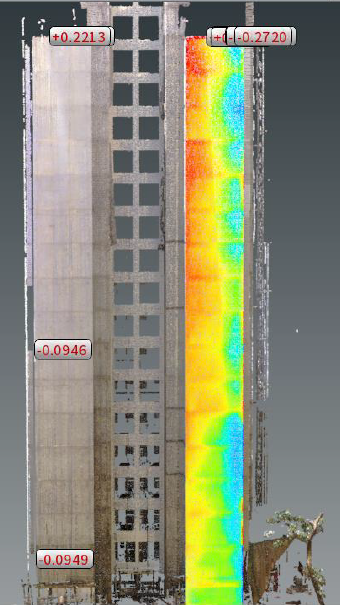
09 / 14
Assess site geometry and document construction conditions.
Building scan with colour-coded geometry analysis.
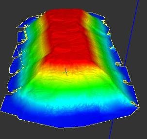
10 / 14
Measure bulk-material volumes and document site geometry.
Bulk-material surface view from the project profile.
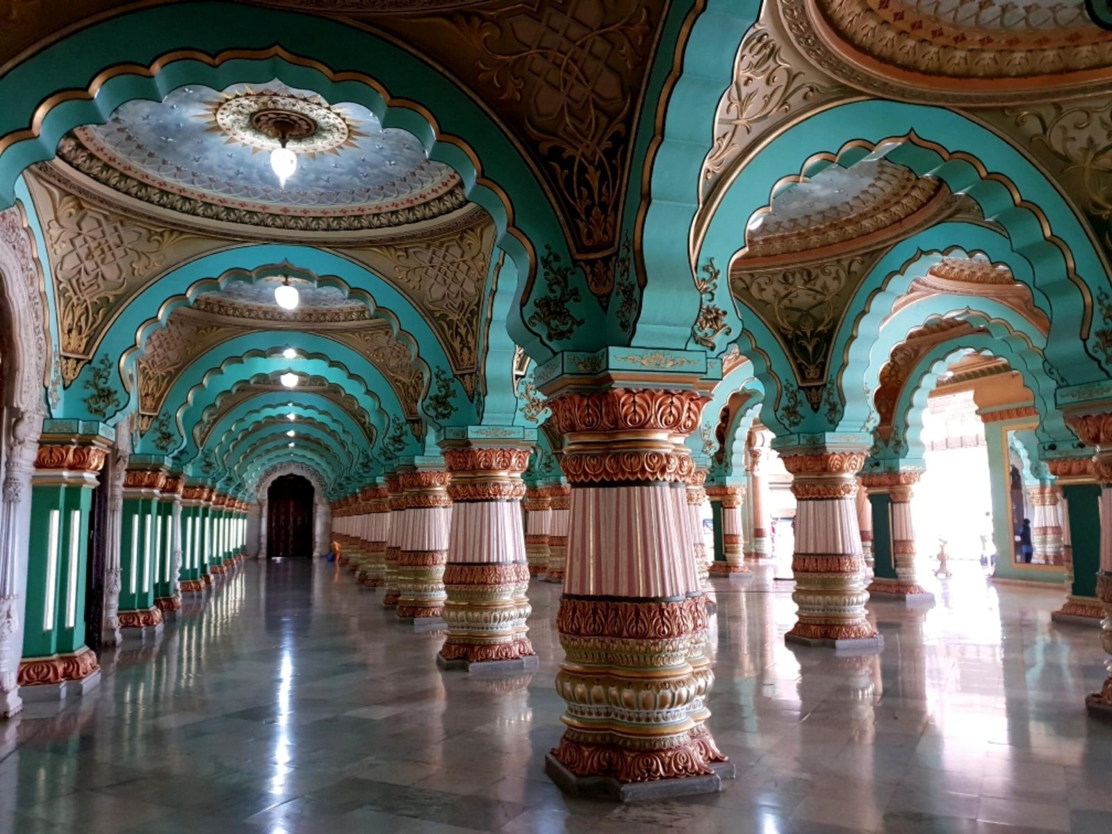
11 / 14
Document heritage geometry and create visual scenes.
Palace interior from the heritage project profile.
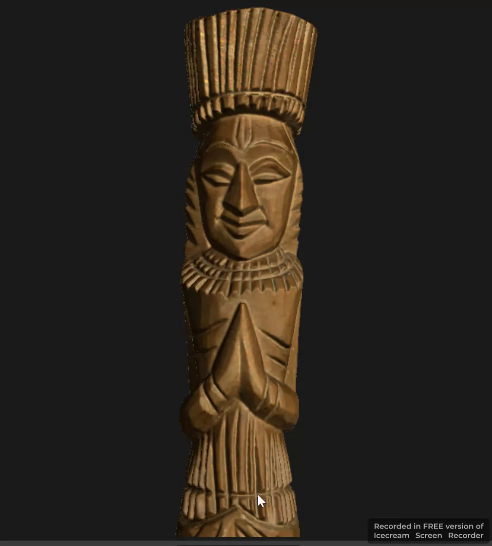
12 / 14
Digitise museum objects for collection documentation, research and digital presentation.
Artifact model view extracted from the supplied video.
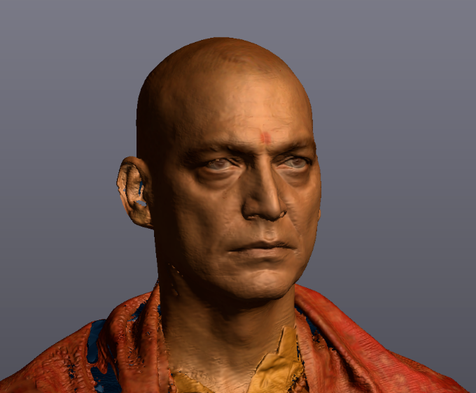
13 / 14
Capture characters and physical props as 3D reference for visual-effects and CGI workflows.
Textured 3D character scan for VFX/CGI workflows.
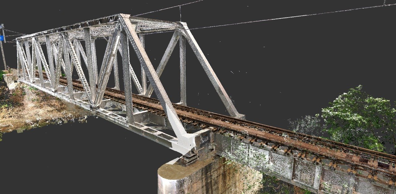
14 / 14
Capture existing bridge geometry for registered point clouds and agreed as-built documentation.
Point-cloud view of a railway bridge and approach tracks.
Find the right expertise
Choose your application to see the scope, deliverables and relevant experience.
Capture accessible part and assembly surfaces for agreed scan-data delivery.
Compare scanned geometry with agreed references and report deviations and suitable feature checks.
Create CAD models and engineering drawings from existing components or customer-supplied scan data.
Inspect components and assemblies against engineering drawings, CAD models and specified tolerances.
Periodic checks, adjustment guidance and remeasurement for manufacturing fixtures.
Capture site geometry and deliver registered point clouds, with modelling scoped separately.
BIM modelling from customer-supplied point clouds, or on-site building capture and modelling within an agreed scope.
Document existing plant equipment, piping and structures for engineering and modification workflows.
Document and assess building geometry, surface flatness, verticality and excavation conditions.
On-site 3D laser scanning of railway bridges for existing-geometry documentation and agreed engineering deliverables.
Capture ship spaces and develop agreed as-built documentation for marine engineering and retrofit workflows.
Laser-scanning-based tank geometry capture, volume-chart preparation and agreed inspection reporting.
Laser scanning for bulk-material volumes, stockyard documentation and underground mapping.
Document sites and objects for heritage records, visualisation and CGI/VFX workflows.
Digitise museum objects for collection documentation, research and digital presentation.
Capture characters and physical props as 3D reference for visual-effects and CGI workflows.
Create processed visual scenes for virtual walkthroughs and digital presentation.
| Your requirement | How we can help |
|---|---|
| Capture a component or site | Physical scanning and delivery of the agreed scan data for your team. |
| Model existing scan data | CAD, BIM, plant modelling and drawings from customer-supplied data, including overseas assignments. |
| Scanning and modelling together | Data capture and the agreed modelling and drawing scope in one assignment. |
| Verify dimensions or geometry | Compare measured features with drawings, CAD references or specified tolerances and report results. |
3D scan data and point clouds for the agreed application.
Reconstructed CAD models, engineering drawings, BIM models and as-built plant models.
Inspection and fixture verification reports, volume reports, calibration charts or processed Gaussian Splatting scenes.
Deliverables depend on your scope. Formats, modelling detail, inspection references and verification requirements are agreed before work begins.
Customer-supplied data · Worldwide delivery
Already completed the scanning? Send a sample of your data and the required outputs. We review coverage, modelling scope and delivery requirements before preparing a quotation.
Assignments may be scanning only, modelling and drawings only, or combined. The quotation identifies our responsibilities and the agreed deliverables.
LNG facilities, refineries, chemical plants, manufacturing sites and power-plant systems.
Including 22 projects undertaken at overseas locations. Marine experience includes ship spaces and retrofit-documentation workflows.
Industrial reverse engineering, portable CMM inspection, buildings, mines and heritage documentation.
Our experience also covers defence and aerospace equipment, offshore platforms, underground environments and controlled-access facilities. We discuss relevant capabilities without disclosing protected customer or programme information.
Yes. We provide on-site services across India, with mobilisation and access arrangements agreed for each assignment.
Yes. We provide scan-to-CAD, Scan-to-BIM and as-built plant modelling and drawing services using customer-supplied data, including for overseas customers. We review sample data before defining the scope.
Yes. Scanning-only assignments can deliver registered data to your team. Modelling-only and combined assignments are also available.
The service, location, approximate component or site size, required outputs, target date and any drawings or sample data. Inspection enquiries should also identify the characteristics and tolerances.
The measurement approach and applicable performance depend on component or site size, equipment, access, reference method and required checks. We review these before agreeing the scope. A customer tolerance is not an instrument-accuracy claim.
We only publish information and visuals suitable for disclosure. Illustrative service images are clearly labelled and do not depict client assignments.
Offices in Ahmedabad and Jamshedpur. On-site services across India. Remote modelling and drawing services for overseas customers using customer-supplied data.
Email inquiry@kkgeosystem.com or call +91 98244 40077.
Send your project location, photographs or sample scan data, approximate dimensions, required outputs and target date. Tell us whether you need scanning, modelling, inspection or a combined service. For confidential projects, contact us before transferring files.