 K K Geo System | 3D Scanning & Metrology Solutions India
Precision 3D Laser Scanning & Dimensional Metrology Solutions
K K Geo System | 3D Scanning & Metrology Solutions India


Engineering services
K K Geosystem provides document and assess building geometry, surface flatness, verticality and excavation conditions.
Our offices in Ahmedabad and Jamshedpur support on-site assignments across India. The proposal defines capture, processing and reporting responsibilities for your requirement.
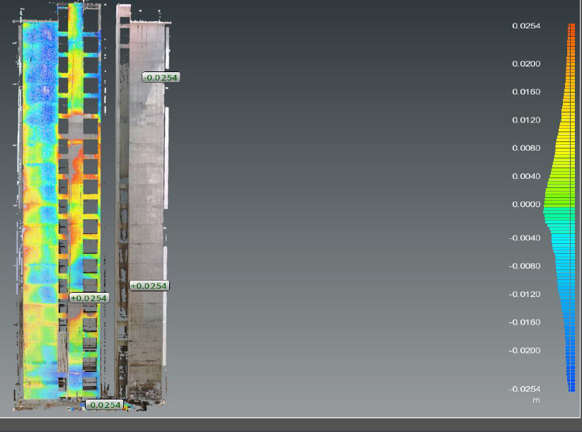
We use laser scanning to capture existing site conditions and prepare geometric assessments against agreed reference information. Projects include residential construction checks and repeated excavation-face surveys.
Deliverables, formats and checks are agreed for each assignment.
Our portfolio includes tower-construction QA/QC and repeat surveys of excavation faces. Reporting dates and reference information are documented for each assignment.
Share the site location, area, reference drawings, characteristics to check and required survey intervals.
| Your inputs | Our agreed work | Delivery |
|---|---|---|
| Survey reference, design data, areas and acceptance tolerances | Agreed flatness, verticality or cut/fill comparisons | Deviation views and scoped geometry reports |
Repeat surveys need consistent reference systems and comparable coverage. Separate measured geometry from the engineer’s interpretation.
Read the legend, units, reference surface and sign convention together. A colour alone does not determine acceptance without the agreed tolerance.
No. Geometry measurement can inform engineering review; structural capacity and safety require the appropriate engineering assessment.
Start with a non-sensitive summary of the requirement. Agree NDA conditions and a suitable transfer method before sharing restricted files. Public project descriptions do not need to identify the end-customer.
Offices in Ahmedabad and Jamshedpur. On-site services across India. Remote modelling and drawing services for overseas customers using customer-supplied data.
Email inquiry@kkgeosystem.com or call +91 98244 40077.
Please include the service required, location, approximate size or data extent, required outputs and target date. For confidential or large files, contact us to agree the transfer method.