 K K Geo System | 3D Scanning & Metrology Solutions India
Precision 3D Laser Scanning & Dimensional Metrology Solutions
K K Geo System | 3D Scanning & Metrology Solutions India


Buildings · Industrial plants · Existing-site documentation
K K Geosystem captures accessible building and plant geometry and delivers registered point clouds for agreed documentation and engineering workflows. We provide on-site services across India from Ahmedabad and Jamshedpur, with BIM or as-built plant modelling available as a separately defined scope.
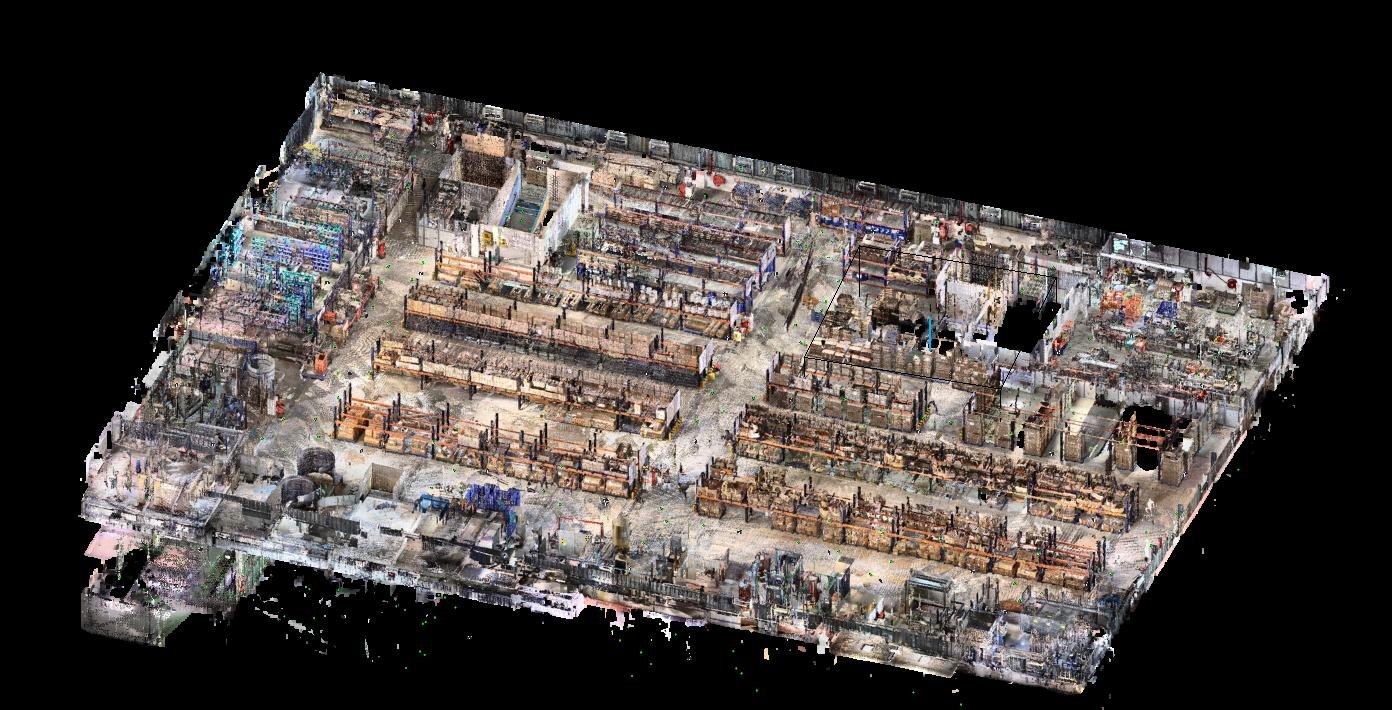
Use site scanning to document existing conditions before modelling, drawing preparation or an agreed engineering review. Define the required areas and accessible entities around the intended use.
| Option | Required information | Delivery |
|---|---|---|
| Site scanning only | Area boundaries, access, coordinates and intended use | Registered point clouds in an agreed format |
| Building scanning and BIM | Required disciplines, model detail and drawing list | Point clouds and commissioned BIM outputs |
| Plant scanning and modelling | Piping, equipment and structural scope | Point clouds and agreed as-built models or drawings |
Coordinate references, registration checks and any survey-control requirements must be agreed before fieldwork.
Our project profile includes an operational LNG facility in Gujarat, power-plant assignments and an operational hospital in Mumbai. The LNG scope records registered, georeferenced point clouds and a gap-analysis report; the hospital scope included point clouds and BIM modelling. These outputs are examples of specific assignments, rather than automatic inclusions in every scan.
Obstructions and access restrictions can leave gaps. Capture extent and any excluded areas should be identified in the scope and reviewed during delivery. A point cloud records observed geometry; hidden systems and engineering attributes require suitable additional information.
Yes. Scanning and registered point-cloud delivery can be commissioned independently.
Yes. Overseas customers can supply data for Scan-to-BIM or As-Built Plant Modelling and drawings. Sample data is reviewed before scope confirmation.
Our experience includes operating facilities. Feasibility, access and working windows are agreed with the site team; uninterrupted operations should not be assumed.
Provide location, approximate area, plans or photographs, required coverage, access restrictions, coordinate needs, outputs and deadline. Identify whether modelling and drawings are required.
Offices in Ahmedabad and Jamshedpur. On-site services across India. Remote modelling and drawing services for overseas customers using customer-supplied data.
Email inquiry@kkgeosystem.com or call +91 98244 40077.
Please include the service required, location, approximate size or data extent, required outputs and target date. For confidential or large files, contact us to agree the transfer method.