 K K Geo System | 3D Scanning & Metrology Solutions India
Precision 3D Laser Scanning & Dimensional Metrology Solutions
K K Geo System | 3D Scanning & Metrology Solutions India


Engineering services
K K Geosystem provides laser scanning for bulk-material volumes, stockyard documentation and underground mapping.
Our offices in Ahmedabad and Jamshedpur support on-site assignments across India. The proposal defines capture, processing and reporting responsibilities for your requirement.
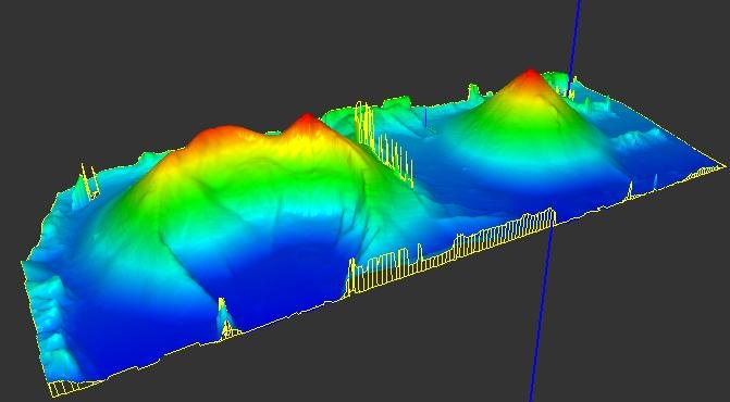
We support stockpile measurement and mine documentation with registered spatial data and agreed volume calculations. The scope defines material boundaries, reference surfaces, coordinates and accessible areas.
Deliverables, formats and checks are agreed for each assignment.
The project profile includes multi-location coal-stock surveys and underground mine and smelter work. Tonnage requires an agreed density basis in addition to volume.
Provide material type, approximate area, stockpile boundaries, access constraints and the required output.
| Your inputs | Our agreed work | Delivery |
|---|---|---|
| Site boundaries, material areas, base reference and access | Agreed stockpile surface capture or underground mapping | Registered data, volume calculations or scoped mapping outputs |
State the survey date, boundary and calculation basis with volume results. Scanned volume alone does not determine material mass without a suitable density basis.
Calculated volume depends on the reference beneath the measured surface. An assumed base can produce a different result from a surveyed base.
No. Underground coverage, access and registration requirements differ from surface material-volume assignments and should be planned separately.
Start with a non-sensitive summary of the requirement. Agree NDA conditions and a suitable transfer method before sharing restricted files. Public project descriptions do not need to identify the end-customer.
Offices in Ahmedabad and Jamshedpur. On-site services across India. Remote modelling and drawing services for overseas customers using customer-supplied data.
Email inquiry@kkgeosystem.com or call +91 98244 40077.
Please include the service required, location, approximate size or data extent, required outputs and target date. For confidential or large files, contact us to agree the transfer method.