 K K Geo System | 3D Scanning & Metrology Solutions India
Precision 3D Laser Scanning & Dimensional Metrology Solutions
K K Geo System | 3D Scanning & Metrology Solutions India


Engineering services
K K Geosystem provides capture ship spaces and develop agreed as-built documentation for marine engineering and retrofit workflows.
Our offices in Ahmedabad and Jamshedpur support on-site assignments across India. The proposal defines capture, processing and reporting responsibilities for your requirement.
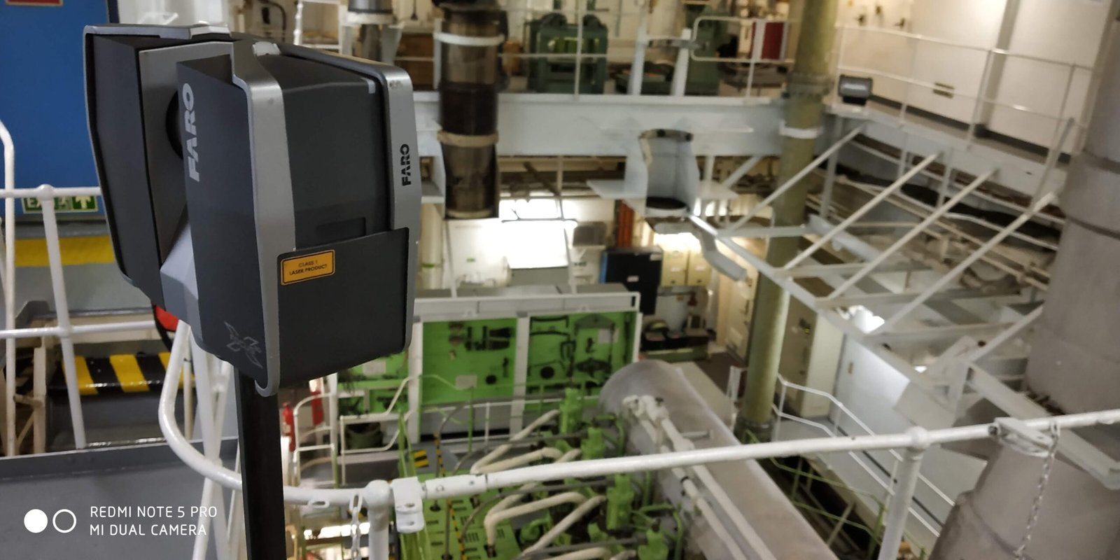
K K Geo System has completed more than 100 marine projects overall, including 22 projects at overseas locations. Our experience includes capture of engine rooms, pump rooms and deck areas for marine engineering assignments.
Deliverables, formats and checks are agreed for each assignment.
Marine project experience is described without vessel identities or end-customer names. Scanning and modelling responsibilities are defined separately for each assignment.
Share the vessel location, spaces to capture, access window, intended engineering task and required deliverables.
| Your inputs | Our agreed work | Delivery |
|---|---|---|
| Vessel areas, access schedule, intended retrofit and output list | Agreed engine-room, pump-room or deck capture | Point clouds and modelling or drawings where commissioned |
Marine experience includes retrofit documentation for BWTS and scrubber workflows. Design approval and class acceptance are separate from geometric capture.
Only when commissioned. The proposal should identify capture, registration, modelling and drawing responsibilities separately.
Provide the areas to capture, available vessel drawings, port or mobilisation arrangements, access restrictions, target dates and required engineering outputs.
Start with a non-sensitive summary of the requirement. Agree NDA conditions and a suitable transfer method before sharing restricted files. Public project descriptions do not need to identify the end-customer.
Offices in Ahmedabad and Jamshedpur. On-site services across India. Remote modelling and drawing services for overseas customers using customer-supplied data.
Email inquiry@kkgeosystem.com or call +91 98244 40077.
Please include the service required, location, approximate size or data extent, required outputs and target date. For confidential or large files, contact us to agree the transfer method.