 K K Geo System | 3D Scanning & Metrology Solutions India
Precision 3D Laser Scanning & Dimensional Metrology Solutions
K K Geo System | 3D Scanning & Metrology Solutions India


Engineering services
K K Geosystem provides document sites and objects for heritage records, visualisation and CGI/VFX workflows.
Our offices in Ahmedabad and Jamshedpur support on-site assignments across India. The proposal defines capture, processing and reporting responsibilities for your requirement.

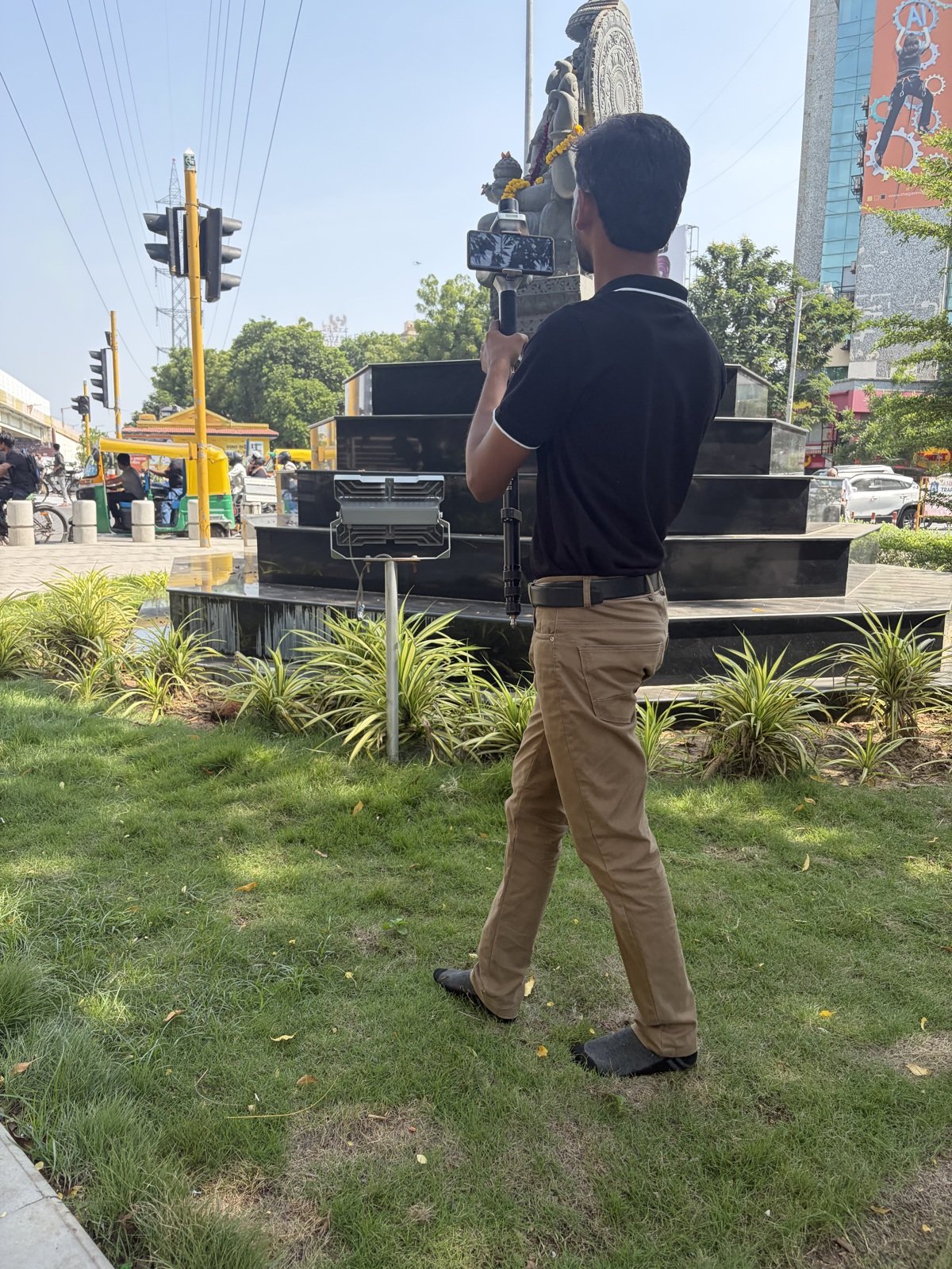
We offer heritage laser scanning and visual capture, including Gaussian Splatting scenes. Capture and processing are selected around the intended deliverable: spatial documentation, a model or a visual scene.
Deliverables, formats and checks are agreed for each assignment.
The portfolio includes monument, cave and palace documentation. A separate Ahmedabad statue-and-pedestal project delivered a processed Gaussian Splatting scene for a virtual walkthrough workflow.
Share the subject, site access, intended use and required output. A visual scene and a dimensionally assessed engineering model have different requirements.
| Your inputs | Our agreed work | Delivery |
|---|---|---|
| Asset extent, permitted access and documentation purpose | Agreed heritage geometry and photographic capture | Spatial data and commissioned documentation |
Documentation scope depends on access and visible surfaces. Do not equate a digital record with a conservation assessment.
Photography can be part of the agreed scope. Clarify whether you need geometric records, visual documentation or both.
Public case studies can omit customer details. Any permissions for field access and publication should be agreed with the responsible party.
Start with a non-sensitive summary of the requirement. Agree NDA conditions and a suitable transfer method before sharing restricted files. Public project descriptions do not need to identify the end-customer.
Offices in Ahmedabad and Jamshedpur. On-site services across India. Remote modelling and drawing services for overseas customers using customer-supplied data.
Email inquiry@kkgeosystem.com or call +91 98244 40077.
Please include the service required, location, approximate size or data extent, required outputs and target date. For confidential or large files, contact us to agree the transfer method.