 K K Geo System | 3D Scanning & Metrology Solutions India
Precision 3D Laser Scanning & Dimensional Metrology Solutions
K K Geo System | 3D Scanning & Metrology Solutions India


Engineering services
K K Geosystem provides document existing plant equipment, piping and structures for engineering and modification workflows.
Our offices in Ahmedabad and Jamshedpur support on-site assignments across India. The proposal defines capture, processing and reporting responsibilities for your requirement.
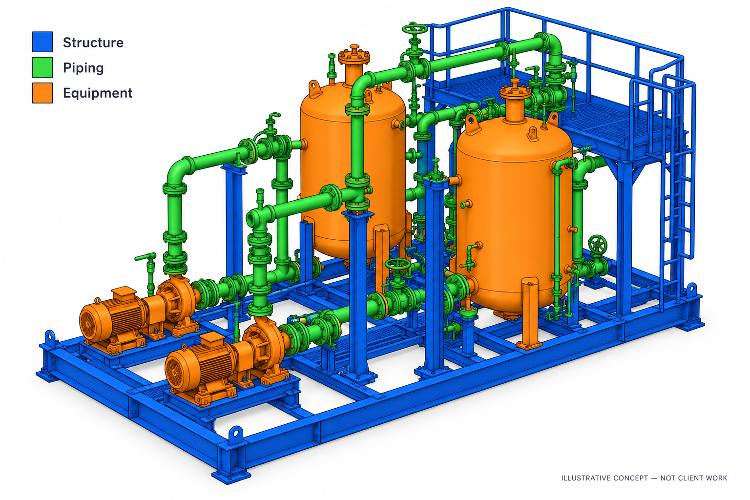
Our plant services cover on-site laser scanning in India and remote as-built modelling from customer-supplied data worldwide. Customers can engage us for scanning only, modelling and drawings only, or a combined assignment.
Deliverables, formats and checks are agreed for each assignment.
Experience includes operating LNG facilities, refinery areas, chemical plants, tank farms and power-plant piping between boiler and turbine areas. Our teams have also undertaken offshore-platform scanning.
Provide the plant area or sample data, equipment and systems to cover, output requirements, access or shutdown constraints and schedule.
| Your inputs | Our agreed work | Delivery |
|---|---|---|
| Point clouds or site access, entity list and coordinate reference | Agreed piping, structures and equipment modelling | As-built model and specified plant drawings |
A geometric model does not establish pipe contents, material specifications or equipment condition. Such attributes require reliable customer records.
No. We offer scanning-only, combined capture and modelling, and modelling from customer-supplied scans, including overseas data.
The required areas, entity types, visible coverage, level of detail and drawing list determine the scope. Identify excluded or inaccessible areas before starting.
Start with a non-sensitive summary of the requirement. Agree NDA conditions and a suitable transfer method before sharing restricted files. Public project descriptions do not need to identify the end-customer.
Offices in Ahmedabad and Jamshedpur. On-site services across India. Remote modelling and drawing services for overseas customers using customer-supplied data.
Email inquiry@kkgeosystem.com or call +91 98244 40077.
Please include the service required, location, approximate size or data extent, required outputs and target date. For confidential or large files, contact us to agree the transfer method.